California’s Snowpack Plummets After a Very Dry January
The gains of an extremely wet December have been muted by an unusually dry January.

For anyone tracking the state of California’s drought, the past four months have delivered an emotional whiplash.
October brought flooding and atmospheric rivers. November was unusually parched.
December broke rainfall records, while January clocked in as the driest ever for large swaths of the state.
The wild swings in precipitation mean that much of the water gains from recent storms are slipping away sooner than any of us would like.
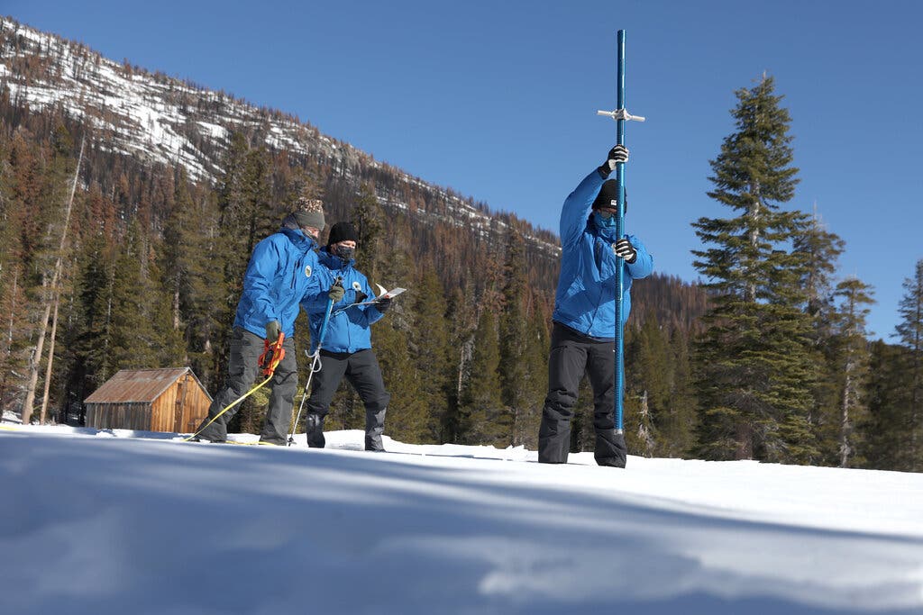
By the end of our extremely wet December, the state’s snowpack, an important source of water, had reached 160 percent of its expected level, a cause for celebration in the midst of a drought.
But by Wednesday, just over a month later, the snowpack had shrunk to 90 percent of its historical level, according to state data.
“That one dry month of January basically wiped out whatever head start we had as we head towards the end of winter,” Sean de Guzman, manager of the snow surveys and water supply forecasting section of the California Department of Water Resources, told The Associated Press this week.
There are two factors at play here. The snowpack is probably melting because of unseasonably warm temperatures. And because January is typically one of the wettest months in California, the historical average is higher now than it was in December.
Here’s another way to think about this: California gets most of its rain between November and March, with January and February typically being the rainiest months.
So missing out on storms in January — and February, as is projected for at least the first two weeks of the month — takes an especially big toll on California’s water supplies.
And, unfortunately, the dry streaks we’ve been experiencing don’t appear to be a fluke.
While the total precipitation California receives each year is unlikely to change significantly this century, the state is projected to experience longer dry seasons and shorter, but more intense, wet seasons because of the effects of global warming, experts say.
Take what happened in October. Sacramento logged its wettest day ever eight days after it broke a very different kind of record — the longest dry spell in the city’s history, with 212 days without rain.
Scientists call these rapid shifts from extreme dry to extreme wet conditions “precipitation whiplash.” By the end of the century, they’re expected to increase in frequency by 25 percent in Northern California and to double in Southern California, according to a 2018 study in the journal Nature Climate Change.
So we might as well get used to these unpredictable weather patterns.
Still, there’s some good news: Even with a dry November, California received more rainfall in the final quarter of 2021 than it had over the previous 12 months.
Before October, 88 percent of California was considered in extreme or exceptional drought, the most severe designations, according to the U.S. Drought Monitor.
Now, 1 percent of the state falls into those categories.
Medio: The New York Times